In a world where everyone is looking towards enhancing the user experience with visually appealing graphics, improved branding and easier to navigate applications; Site Plans also need to have an improved graphic appeal.
Site Maps are drawings of a site, created at a reduced scale, to present the layout of the site showing the position of buildings, roads, streets, etc. within the site.
Large campus Universities, Educational institutes, Colleges, Schools, Hospitals, Community condominiums, etc., display the Site Maps near their Main Gates or reception areas or at multiple places on the entire site, with “You are here” indications, to help the visitors to navigate around the property.
This is where Digitise IT can help!
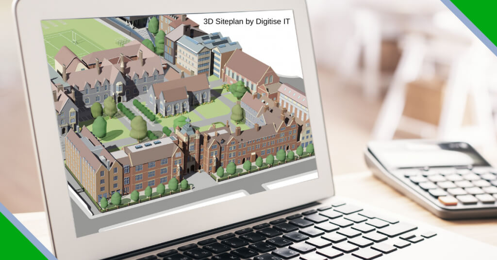
We create visually appealing, graphically enhanced 3D Site Plans with
- the site buildings modelled in 3D as a reduced size representation of the actual building on the site.
- 3D models of the buildings in a 2D site layout roads and lanes for navigation understanding
- Other elements of the site such as play grounds, parking, fencing and other elements are also represented
- The sites are lined with plants and trees to add a realistic feel to the Map
3D Site maps enhance the user experience of the visitors as they can
- co-relate the 3D model of the buildings with the actual buildings on the site
- The legend markings on the sitemap indicating building names, street names, etc. presents, easy to understand navigation help document.
- appreciate the Architectural aspects, surroundings and the expanse of the sites
- visualise themselves in the site and mentally navigate their way around the site easily and quickly
3D Site maps can be used as a focal point when a map is displayed through a wall-mounted acrylic wall display. They can also be used as a professional marketing tool in brochures or websites, as it helps to create the right impression in a unique and distinct way, showing the expanse of the site.
Interactive 3D Site maps can be used on a website to use as Interactive navigation tool for visitors.
See our demo of Interactive site plan here
Digitise IT – How We Do It
At Digitise IT, we make use of specialized graphics softwares like Sketchup Pro, 3D Max, Adobe Illustrator, Adobe Photoshop, Webrotate 360, etc. to create interactive 3D site plans for schools, colleges, and universities, hospitals, etc. to use easy to understand navigation map.
You can send us your site layout, google map aerial images with a marking of the site outline, photographs of the various buildings, play grounds and other areas on the site.
We create a 3D visual model of each building, playground and details of the site with beautiful colors and textures. We provide the site plans as standard files that can be edited for bespoke annotations and overlays. One of our design team experts will work closely with you for the purpose of creating an exquisite interactive 3D map.