Outsource Point Cloud Modeling & Conversion Services:
A Practical Guide for Surveyors & Engineers
Everything architecture, engineering, and surveying firms need to know before outsourcing point cloud conversion — deliverables, costs, quality benchmarks, and what separates expert partners from data processors.
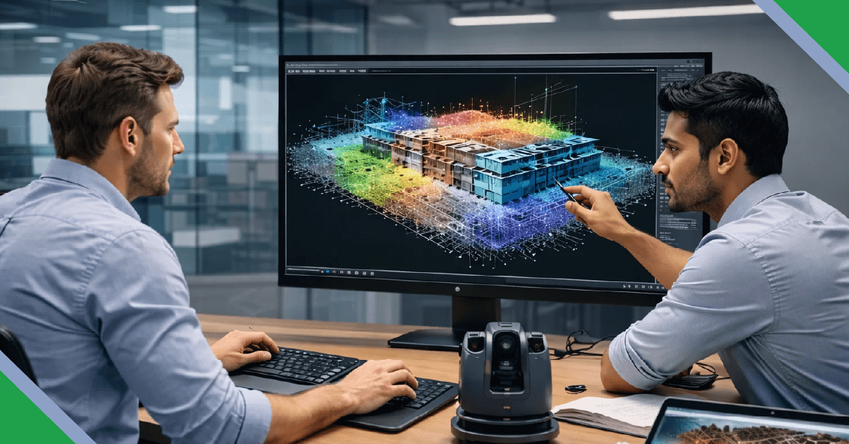
You've captured the scan data. The point cloud files are sitting on your server — millions of points representing a building, plant, or site in precise three-dimensional detail. Now comes the question that determines whether that data becomes a business asset or an expensive hard drive occupant: who is going to turn it into usable drawings and models, and how fast?
For most architecture, engineering, and surveying firms, the honest answer is that processing point cloud data in-house — at volume, at speed, and at the quality level clients now expect — is neither efficient nor economical. The specialist software, trained operators, and dedicated processing time required make outsourcing not just viable but, for many firms, the only commercially sensible option.
This guide is written for the people making that outsourcing decision: project managers, practice principals, and technical leads who need to know exactly what to expect, what to pay, what to demand, and how to avoid the mistakes that turn a promising outsourcing arrangement into a rework headache.
Sources listed in References section. Market figures are estimates and may vary by research methodology.
- What Outsourced Point Cloud Modeling Actually Delivers
- Why In-House Processing Often Fails at Scale
- Point Cloud Conversion Services: What's Included
- Industries & Use Cases
- How to Evaluate a Point Cloud Outsourcing Partner
- Quality Benchmarks to Demand
- The Outsourcing Process: Step by Step
- Common Mistakes & How to Avoid Them
- Frequently Asked Questions
What Outsourced Point Cloud Modeling Actually Delivers
There is a persistent misconception that point cloud outsourcing is simply a data conversion task — upload a scan file, receive a DWG. In reality, professional point cloud modeling services involve substantial technical interpretation, modelling judgement, and quality control that cannot be automated away.
What a competent outsourcing partner actually delivers:
2D As-Built CAD Drawings
Floor plans, elevations, sections, and reflected ceiling plans derived from point cloud data — accurately scaled, layered to client standards, and delivered in DWG or DXF.
3D As-Built BIM Models
Revit or other BIM models built to the specified Level of Development (LOD 200–400), including structural, architectural, and MEP elements as appropriate.
Architectural Drawings
Construction-quality architectural documentation — measured drawings, planning submissions, heritage records — built from scan data rather than manual measurement.
MEP Coordination Models
Existing services documentation — HVAC, pipework, electrical — modelled from scan data to support retrofit and refurbishment design.
Plant & Facility Models
Process plant, industrial facility, and infrastructure as-builts for maintenance planning, expansion design, and regulatory compliance.
Site & Survey Deliverables
Topographic surveys, site plans, cross-sections, and earthworks models derived from drone LiDAR or terrestrial scan data.
Why In-House Processing Often Fails at Scale
Many firms begin processing point cloud data in-house and find it manageable for the first few projects. The problems typically emerge when project volume increases, client turnaround expectations tighten, or the complexity of scan data grows. Here is an honest comparison of what in-house versus outsourced processing looks like at scale:
In-House Processing Challenges
- Skilled point cloud modellers are scarce and expensive to recruit
- Software licence costs (ReCap Pro, Revit, NavisWorks) add up quickly
- Processing capacity is fixed — surge projects create bottlenecks
- Staff turnover creates knowledge and workflow gaps
- Nights and weekends still don't compress turnaround enough
- QA is often the first thing cut under deadline pressure
Outsourcing Advantages
- On-demand capacity — scale up for large projects, scale down between jobs
- Fixed per-project or per-unit pricing — no overhead during quiet periods
- Offshore time zones compress turnaround — work progresses while your office sleeps
- Specialist teams with deep platform expertise and established QA workflows
- No recruitment, training, or retention cost
- Predictable delivery timelines included in contractual scope
Point Cloud Conversion Services: What's Included
Point cloud conversion services cover the full pipeline from raw scan data to finished deliverable. Understanding what each stage involves helps you specify your requirements clearly and evaluate partner proposals on a like-for-like basis.
The Point Cloud Conversion Pipeline
Data Receipt & File Validation
Accepting scan files in all major formats (RCP, RCS, E57, LAS, LAZ, PTX, PTS, XYZ) and validating completeness — checking scan coverage, registration quality, and noise levels before modelling begins.
Point Cloud Registration & Cleaning
Where scan registration has not been completed by the survey team, individual scan stations are registered into a unified coordinate system. Noise, outliers, and scan artefacts are filtered to improve model accuracy.
Modelling or Drafting
The core technical work: tracing, modelling, and interpreting the point cloud to produce the agreed deliverable — 2D CAD drawings, a Revit BIM model, or other format. This is where human expertise and interpretation is irreplaceable.
Attribute & Data Population
For BIM deliverables, populating element parameters — materials, dimensions, system classifications — to the agreed LOD. For CAD, applying correct layer structure, line weights, and annotation per client standards.
Internal Quality Assurance
Multi-stage checking: dimensional accuracy spot-checks against the point cloud, completeness review, drawing standard compliance, and — for BIM — model integrity validation.
Delivery & Client Review Support
Delivering agreed files with a revision log; supporting client review comments and incorporating amendments within agreed revision rounds.
Accepted File Formats & Outputs
| Input Format | Source Equipment | Typical Output | Common Software |
|---|---|---|---|
| RCP / RCS | Leica, FARO, Trimble scanners (via ReCap) | DWG, RVT, NWD | AutoCAD, Revit, NavisWorks |
| E57 | Universal exchange format — most scanner brands | DWG, RVT, IFC | ReCap, Revit, Cyclone |
| LAS / LAZ | Drone LiDAR, airborne survey | DWG, SHP, TIN surface | Civil 3D, ArcGIS, CloudCompare |
| PTX / PTS | Leica scanners (raw format) | DWG, RVT | Cyclone, ReCap |
| Matterport (.xyz / .e57) | Matterport Pro cameras | DWG, PDF, RVT | ReCap, Revit |
| XYZ / ASCII | Various — generic point format | DWG, surface model | Civil 3D, CloudCompare, Revit |
Industries & Use Cases
Point cloud outsourcing is not sector-specific — the ability to capture existing conditions precisely and convert them efficiently is valuable across every built environment discipline. These are the sectors where outsourced point cloud modeling services deliver the clearest commercial return:
| Sector | Typical Project Type | Primary Deliverable | Key Benefit |
|---|---|---|---|
| Architecture & Heritage | Renovation, refurbishment, listed building records | 2D measured drawings, 3D Revit model | Eliminates manual re-measurement entirely |
| MEP & Building Services | Retrofit, plant replacement, services coordination | 3D MEP as-built model (Revit/CAD) | Clash-free design without site revisits |
| Surveying & Mapping | Topographic survey, measured building survey | 2D CAD drawings, surface model | Fast turnaround; frees surveyors for more fieldwork |
| Construction & Contractors | Existing conditions verification, progress monitoring | As-built CAD drawings, deviation analysis | Reduces clash risk and costly on-site corrections |
| Oil, Gas & Industrial | Brownfield plant as-built, expansion design basis | 3D plant model, piping isometrics | Safe, accurate data without extended plant access |
| Civil & Infrastructure | Bridge surveys, road corridors, tunnels | Surface model, cross-sections, CAD alignment | Captures complex geometry efficiently |
| Facilities Management | Space management, maintenance planning, digital twin | LOD 300–400 Revit model with COBie data | Accurate handover documentation from day one |
How to Evaluate a Point Cloud Outsourcing Partner
The point cloud services market includes a broad spectrum of providers — from individual freelancers with a Revit licence to specialist offshore studios with dedicated scan-to-BIM teams. The difference in output quality, reliability, and commercial value is enormous. Here is a structured framework for evaluating providers before committing project work.
Partner Evaluation Criteria
Weighting Guide — What Matters Most
Questions to Ask Before You Commit
| Question | What a Good Answer Looks Like | Red Flag |
|---|---|---|
| What scan formats do you accept natively? | Named formats: E57, RCP, LAS, PTX, Matterport — with specific software named | "We can handle most formats" with no specifics |
| What LOD levels do you deliver? | Clear LOD definitions per BIM Forum or national standard; examples provided | Vague references to "high detail" without LOD numbers |
| What is your QA process? | Documented multi-stage check: modeller → checker → QA lead; accuracy spot-check methodology described | "Our team checks everything before delivery" |
| Can you provide a sample from a similar project? | Yes, with client permission or anonymised — and willingness to do a paid test project | Refusal, or portfolio of unrelated project types |
| What happens if the delivery is late or inaccurate? | Clear SLA language; defined revision rounds; escalation contact named | No written commitment on turnaround or accuracy |
| How is our scan data stored and protected? | NDA standard; access-controlled servers; data deletion policy on project completion | No NDA offered; vague server location |
Quality Benchmarks to Demand
Before sending your first project to any outsourcing partner, establish minimum quality thresholds in writing. These are the benchmarks that separate professional point cloud conversion services from commodity data processing:
Positional Accuracy
For building-scale projects: ±5mm dimensional accuracy against the source point cloud for primary elements. Structural elements (columns, walls, slabs) should be modelled to within scan noise tolerance — typically ±2–3mm for modern terrestrial scanners.
Layer & Naming Compliance
All delivered drawings must follow the client's layer standard (BS 1192, NBS, or firm-specific) — not the outsourcing partner's internal convention. Insist on this upfront and provide your layer standard with the brief.
Completeness Coverage
Every visible and scannable element within the agreed scope should be represented. A completeness checklist — agreed before modelling begins — prevents disputes about what was and wasn't included.
BIM Model Integrity
For Revit deliverables: no unplaced elements, no warnings above the agreed threshold, no duplicate elements, and clash-free geometry. Request a model health report with delivery.
Revision Round Definition
A minimum of two revision rounds should be included in the base price. Understand what constitutes a revision versus a scope change — and get this defined in writing before work starts.
Deliverable Formats
Native files only (RVT, DWG) — never just PDF or image exports as primary deliverables. You must be able to edit the output in your own software without rework.
Turn Your Scan Data into Finished Drawings — Fast
DigitiseIT has processed point cloud data from FARO, Leica, Trimble, and Matterport equipment for clients across the UK, Europe, Australia, and North America for over 25 years. Send us your files today.
Request a Free Project QuoteQuote turnaround within 24 hours | NDA available on request | Revisions included
The Outsourcing Process: Step by Step
For firms new to outsourcing point cloud work, understanding what a well-run engagement looks like — from first contact to final delivery — removes uncertainty and sets expectations correctly on both sides.
Initial Brief & Scope Agreement
You share scan files (or a sample) along with the project brief: deliverable type, LOD, drawing standards, coordinate system, and required turnaround. The partner assesses and returns a fixed-price quote or T&M estimate.
NDA & File Transfer
NDA executed if required. Files transferred via secure channel — typically SFTP, WeTransfer Pro, or a shared cloud workspace. Confirm file receipt and integrity before work starts.
Kick-off & Clarification
A brief call or written exchange to clarify ambiguities: scan gaps, scope boundaries, drawing conventions, and any client-specific requirements. This prevents mid-project surprises.
Modelling & Internal QA
The partner's team processes and models the data. Internal QA is conducted before anything reaches you. For larger projects, interim milestone deliveries allow you to check direction early.
First Delivery & Client Review
You receive the first issue for review against your brief. Consolidated comments are returned to the partner — ideally as marked-up PDFs or model comments rather than verbal feedback.
Revisions & Final Delivery
Comments incorporated within agreed revision turnaround. Final native files delivered with a revision log and — for BIM projects — a model health report.
Common Mistakes & How to Avoid Them
Based on experience processing point cloud data for clients across multiple continents, these are the most frequent mistakes firms make when outsourcing — and the straightforward fixes:
| Mistake | Consequence | Fix |
|---|---|---|
| Not specifying LOD upfront | Receiving a model that is either overworked (expensive) or under-detailed (unusable) | Agree LOD per element type in writing before work starts — use BIM Forum LOD definitions |
| Sending unregistered scan data | Partner charges additional time for registration; delays the project start | Complete registration before transfer, or agree registration as a separate billable step |
| No drawing standard provided | Deliverable uses partner's internal layer conventions — requires rework to match your office standard | Include your layer standard, title block, and DWG template with the brief |
| Verbal feedback on revisions | Misunderstood comments lead to repeat revision rounds and delay | Always return comments as marked-up PDFs or numbered model comments |
| Choosing on price alone | Lowest-cost provider delivers a model that costs more to fix than it saved | Run a paid test project on a non-critical deliverable before committing volume work |
| No milestone check on large projects | Problems only discovered at final delivery — too late and too expensive to fully correct | Agree intermediate delivery milestones (25%, 50%) on any project over 10 days |
Frequently Asked Questions
References
- [1] Grand View Research — 3D Scanning Market Size, Share & Trends Analysis Report, 2023–2030. Market size and CAGR estimates for the global 3D scanning and point cloud services sector. grandviewresearch.com
- [2] FMI Corporation / Autodesk — Hacking the Construction Industry (2018). Cited figure relates to rework costs attributed to poor project data and communication; the 30% figure is a widely cited industry estimate across multiple studies. Treat as indicative, not precise.
- [3] Leica Geosystems / RICS — Multiple industry white papers document 5–10× speed improvement of laser scanning vs. manual survey for existing conditions capture. Exact ratio varies by project type and site complexity.